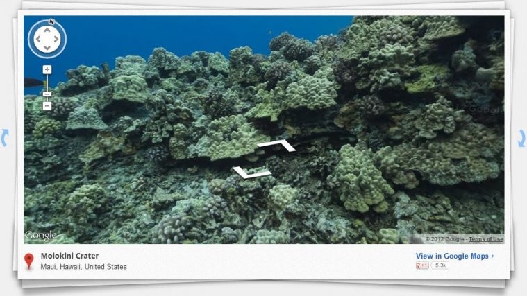
Google continues to make their Maps service better and better by constantly adding new features to it, and this time they’ve gone beyond anything people were expecting. Google Maps now allows you to explore underwater images of six different underwater coral reefs.
You can browse through underwater reefs of Heron Island, Lady Elliot Island, Molokini Crater, Hanauma bay, Apo Islands, and Wilson Island by panning and dragging on the screen with the mouse. Images are of high resolution and pretty clear, making it a fun and almost awe-inspiring time navigating underwater through these reefs.
The underwater coral reef maps can be found at the Google Street View website. Go check them out and get a glimpse of the underwater world.


